Gandy Dancer State Trail
Rail-trail in Minnesota and Wisconsin · OpenStreetMap relation
Finding you…
Ahead to end–Behind to start–
Next trailhead–Speed–
The Gandy Dancer State Trail is a 98-mile recreational trail spanning through Wisconsin and Minnesota. The trail is managed by Polk, Burnett, and Douglas County in Wisconsin and the Minnesota Department of Natural Resources in Minnesota.
From Wikipedia2 (CC BY-SA). Help improve the article and it improves here.
.jpg)
About this trail
Photos
-
 Gandy Dancer Trail Directory - Siren, Wisconsin (35091668885).jpg
Photo: Tony Webster from Minneapolis, Minnesota, United States · CC BY-SA 2.0 · Wikimedia Commons -
 Gandy Dancer Trail Directory - Siren, Wisconsin (44116202941).jpg
Photo: Tony Webster from Minneapolis, Minnesota, United States · CC BY 2.0 · Wikimedia Commons -
 Yellow River Public Access - Webster, Wisconsin (34961519601).jpg
Photo: Tony Webster from Minneapolis, Minnesota, United States · CC BY-SA 2.0 · Wikimedia Commons -
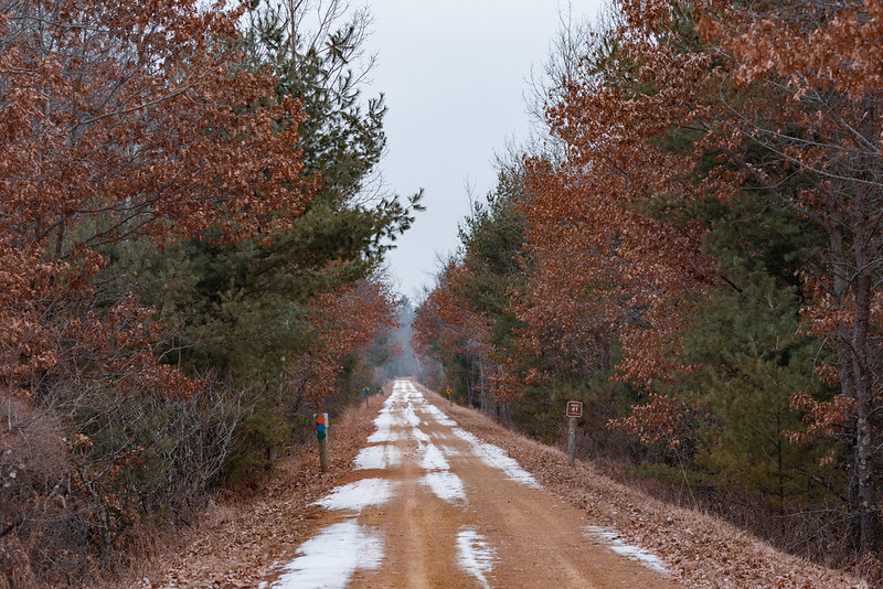 Gandy Dancer Trail - Webster, Wisconsin
Photo: Tony Webster · CC BY-SA · Flickr -
 Gandy Dancer Segment - Ice Age Trail
Photo: Amy Bayer · CC BY-ND · Flickr
.jpg)
.jpg)
.jpg)
Photos and rider notes
Trailheads
- 1 Parking directions
- 2 Parking directions
- 3 Parking directions
- 4 Parking directions
- 5 Parking directions
- 6 Parking restrooms directions
- 7 Parking restrooms · water directions
- 8 Parking restrooms directions
Take it with you
Open data, ODbL. Attribute BikeTheRail and OpenStreetMap contributors.
Something wrong?
Closed section, wrong surface, missing piece? Tell us and a person will check it. Report a problem.
Sources
- OpenStreetMap relation 5547484, OpenStreetMap contributors · Map data · ODbL · checked Oct 12, 2026
- “Gandy Dancer State Trail”, Wikipedia · Encyclopedia · CC BY-SA 4.0 · checked Oct 12, 2026
- Wikidata Q85762635, Wikidata · Knowledge base · CC0 · checked Oct 12, 2026
Every fact above cites a numbered source and the date it was last checked; the list is rebuilt nightly. Know a better source? Add a reference.